In early October, my brother Dennis, cousin Steve, and I hiked about 7 km down the South Kaibab trail to the Tonto Trail cutoff, then about 6 km across to Indian Gardens, then about 7 km up the Bright Angel Trail. While the hike was strenuous, it was not exhausting for me. A few hints worth passing on:
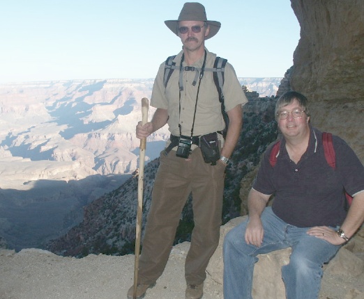
The trail started at the South Kaibab trailhead, so we parked my car near the Bright Angel Trail and took the early morning shuttle bus (half empty) to the starting point. At the start, we were fresh and ready to hike. Captions appear under the photos (photos taken by Don and Dennis).
Steve (left) carried a walking stick; we both started with long pants for comfort in the cool morning. The trail offered great views of the canyon.
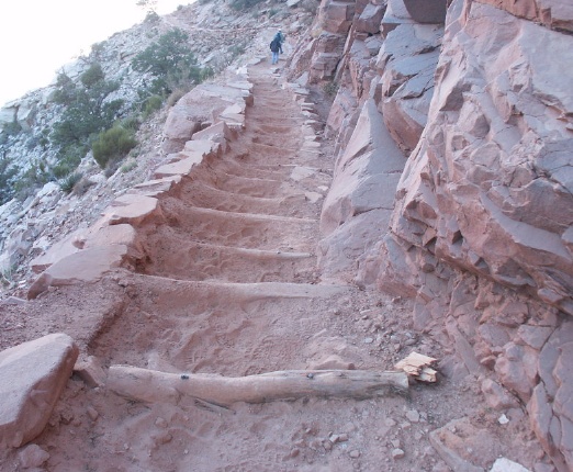
Much of the hike used logs, probably to help preserve the trail used by mules and people. The steps were about 300 mm to 500 mm high. It took concentration to not twist an ankle going down over the many steps. The trail was mainly dry dirt and sand. Few loose rocks were noted.
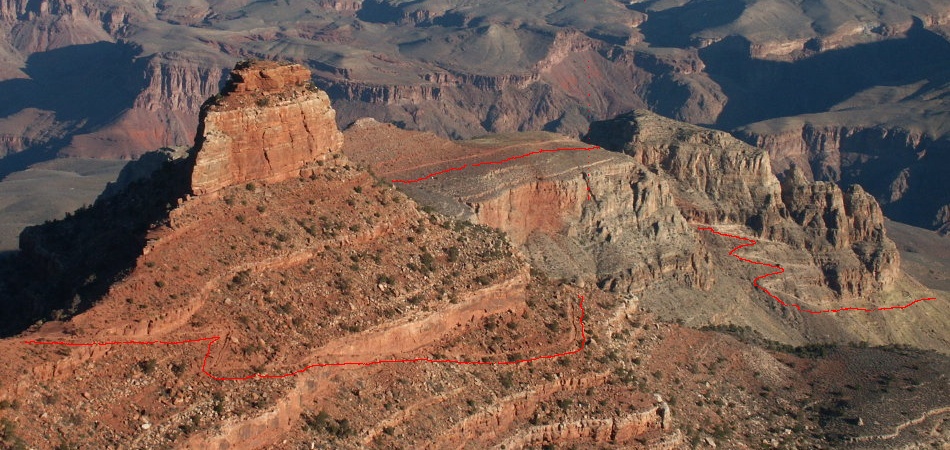
The South Kaibab trail route is marked in red, as seen from near the beginning of the trail. The trail goes down to the plateau just out of view on the right side. (I'm not sure I marked the middle part correctly.) Most sections had wonderful views of the canyon.
At the ~7 km point, where the Tonto Trail cuts off, a rest station is provided. Not much shade here, but the weather in October was still mild. Here is where we changed from long pants to short pants for the rest of the trip. It took a few hours to get here, but we were stopping a lot to take pictures.
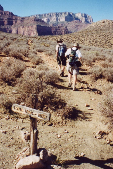
The Tonto Trail marker is not easy to find, but its pretty close to the rest station. A park ranger happened by about this time and pointed it out to us. The path is pretty flat for the next 6 km, and easy to follow. Steve and Dennis are in the lead here. A few more hours took us to Indian Gardens.
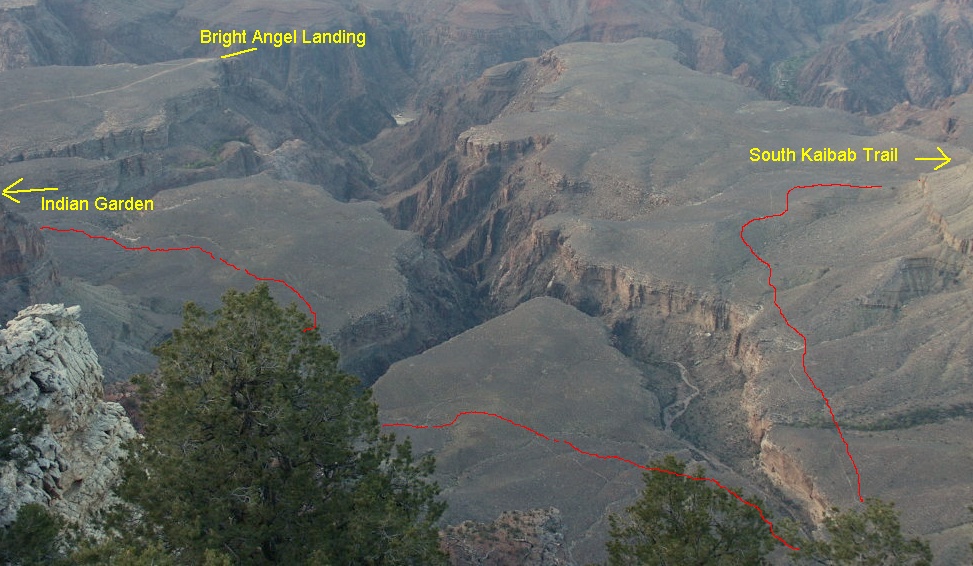
The approximate route of the Tonto Trail is marked in red, from a picture taken from the south rim. The trail goes around the two chasms until it reaches the Indian Gardens area on the Bright Angel Landing trail.
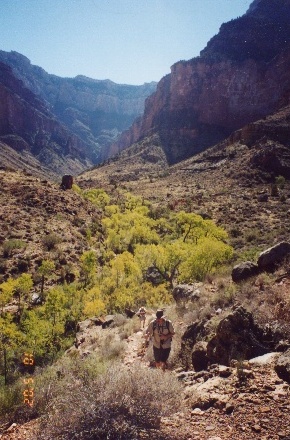
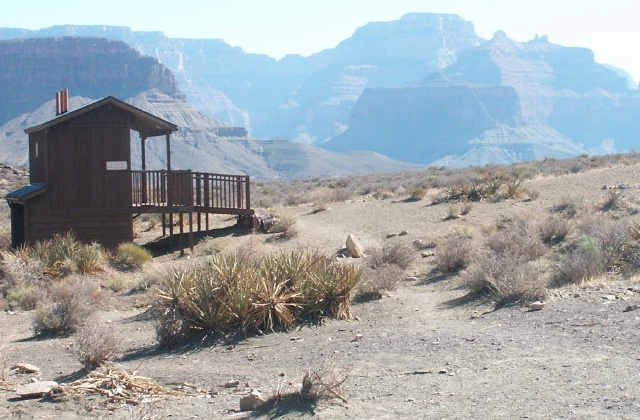
There was not a lot of shade along the Tonto Trail, but at the head of each chasm was an oasis of green trees and places to sit and rest in the shade.
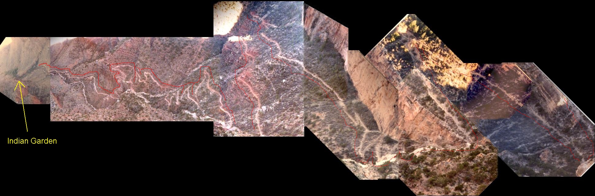
The hardest part of the hike was from the Indian Gardens back up to the top. The mosaic here was taken from the Trail Viewpoint on the south rim the afternoon before the hike. (For a larger picture, requiring scrolling to see the entire scene, click on the image). The trail is outlined in red. There were lots of people at Indian Gardens who had hiked down about 7 km, and were ready to return to the rim. We had already hiked about 13 km, but they were easy km. There was plenty of water and places to rest in the shade. We started up about 1 pm.

A few hours later, we were about half-way to the top. By now, most of the trail was in the shade, but there were still lots of big steps over the logs. Dennis was in a little better shape at this point than I was, but we were both equally sore the next few days from the hike. At the top, were were tired, but not exhausted. We reached the top just before sunset, when the temperature was comfortably cool. We walked back to the car, stopping at some gift stops along the way. The hike was a great experience, and one that I could easily repeat.
If you found this description useful before you take your own trip to the Grand Canyon, please let me know at dbruns@stellarproducts.com. Any mistakes in the text and images are also appreciated.All text and images are owned by Stellar Products, 1992-2003. Any use by others without permission of Stellar Products is prohibited.
Links to other Stellar Products pages: